
How Branford Streets Become Searchable
Street work in Branford is strongest when each step produces a key for the next. Branford's 2021 street list gives alphabetized names and number ranges, while a specific USPS result checks delivery spelling and ZIP. Keep the Branford source line, normalized town, place label, and retrieval date in separate fields. A village label such as Short Beach, Pine Orchard, or Stony Creek may be useful context, but the legal municipality remains Branford.
- Normalize the address. Use the Branford street list for spelling and ranges, then use the USPS lookup for a specific street, city, state, and ZIP. Preserve the original wording too.
- Run Vision by Address first. Save PID, MBLU, account, location, owner label, mailing line, sale display, and Book/Page. If the address fails, try Owner, Acct#, PID, past-owner, or segmented MBLU.
- Open Branford GIS MapXpress at the parcel scale. Record the parcel or unique ID, turn on adjacent parcels, and note layers, update labels, and the map disclaimer.
- Use the voter route or land-record route according to the question. For registration, use the Branford Registrar or the Branford state lookup. For title, carry Book/Page into the Branford Town Clerk and RecordHub. A voter result is not an owner result.
- For an older street pass, check the criss-cross or street index, then compare the dated entry with newspapers, census material, or Branford archive holdings. A historical listing should keep its year and page instead of being treated as a current household.
Branford Street Keys in Vision
Vision is Branford's first modern address stop because its form accepts more than a name. The Branford source dropdown offers Address, Owner, Acct#, Mblu, PID, and All. No field was marked required, but at least one usable value is needed. The Branford MBLU breaks a Branford parcel key into seven parts. Keep its punctuation and leading zeroes.
| Vision control | Type | Required? | Branford notes |
|---|---|---|---|
| Search source | Dropdown | Not marked | Address, Owner, Acct#, Mblu, PID, or All |
| Address | Text | Not marked | Use the street line and number; exact partial-match rules were not captured |
| Owner | Text | Not marked | Owner-name search; treat the result as an assessment label |
| Acct# | Text | Not marked | Account-number key shown on the parcel card |
| PID | Text | Not marked | Stable parcel bridge when an address or name changes |
| Past Owner | Text | Not marked | Historical owner field; not a complete deed chain |
| MBLU | Seven text fields | Not marked | Map, Map Cut, Block, Block Cut, Lot, Unit, Unit Cut; captured maximums 7/3/7/7/7/7/3 |
| Action | Button | Not marked | Search; use at least one usable value |
The Branford public parcel card can show location, MBLU, account, owner label, mailing address, values, PID, sale and Book/Page, building details, ownership history, land/use, and valuation history. Branford's Assessor office lists public-record hours Monday through Friday, 8:30 to 4:30, and phone 203-488-2039. A Branford field card or grand-list year can also be requested. An assessment label is not a certified deed or occupant record.
The public Vision parcel card shows how a Branford street directory row can retain location, owner label, mailing line, values, sale details, and Book/Page.
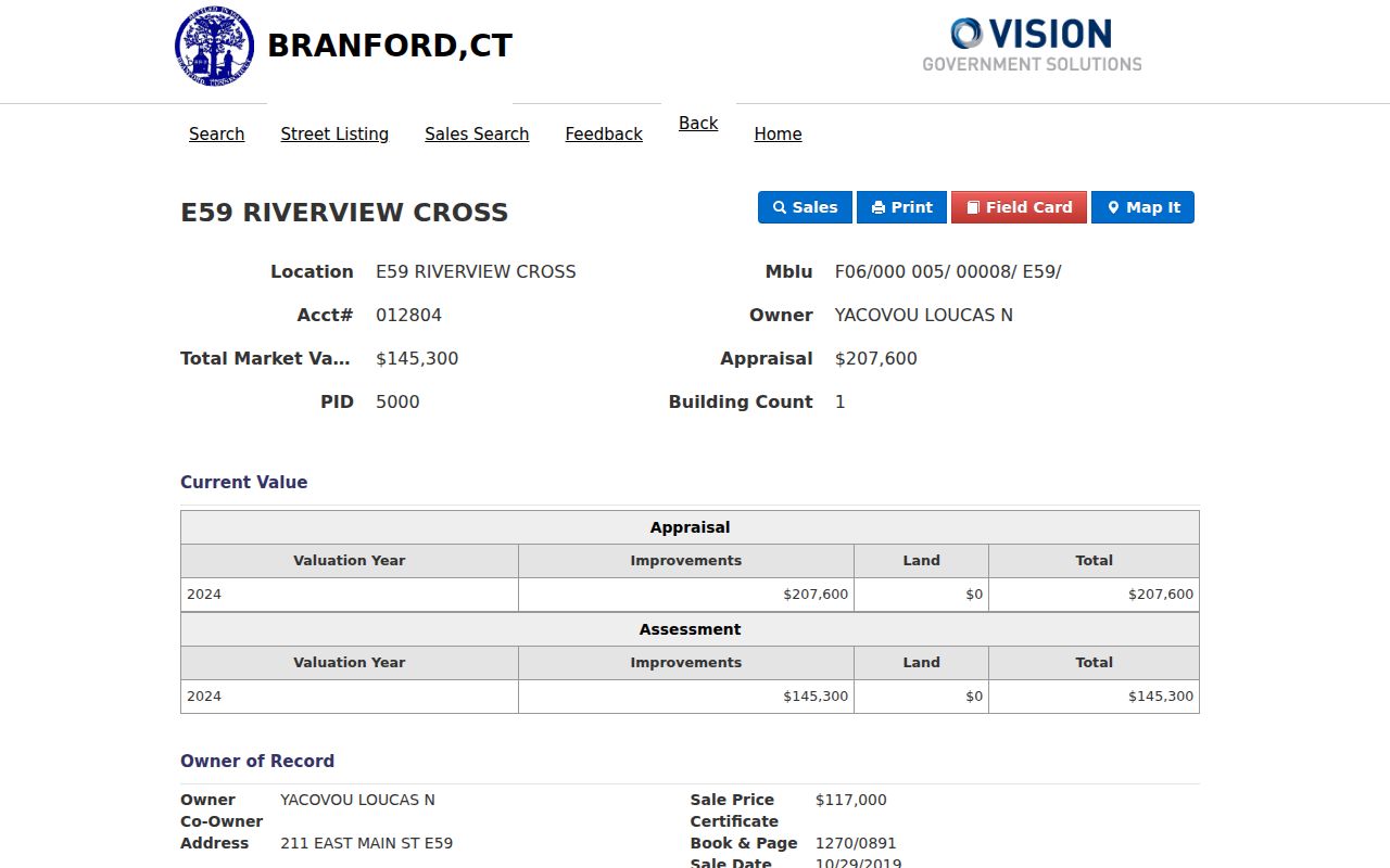
For Branford, copy each displayed field into its own column. The mailing line is a delivery clue, not automatic proof of situs or occupancy.
Branford GIS Parcels and Street Layers
MapXpress gives the Branford street directory a spatial check. Search or click a parcel, note its MBL or unique ID, turn on adjacent parcels, and compare the parcel key with Vision. Branford layers include Parcel Information, zoning, historic properties, voting districts, schools, wetlands, sewer service, FEMA, contours, aerials, trails, shoreline, and measurement tools. A GIS neighbor click is a spatial lead, not a Branford title search.
The Branford GIS map gallery supplies dated map context for a street record.
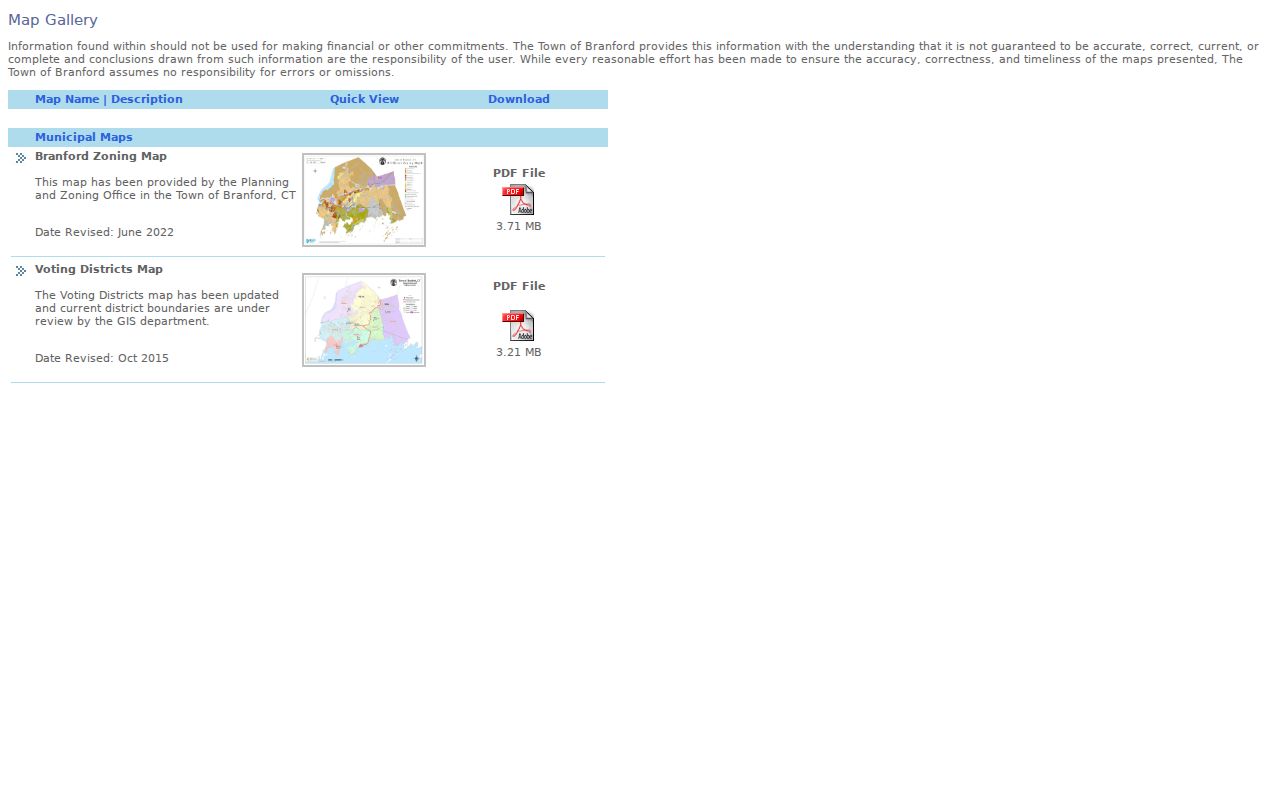
Branford GIS layers can explain why a Branford address sits near a district, school, wetland, sewer area, or historic property. Branford's disclaimer matters: map data may not be current, complete, accurate, or legally official.
Branford Address Records at a Glance
Branford has several address-keyed record sets, held by different custodians with different meanings. The Branford table keeps the modern street directory focused on parcel, map, legal, election, project, engineering, and dated-listing evidence for Branford addresses.
| Address-keyed record | Keeper | What it shows | Access |
|---|---|---|---|
| Assessor address/owner search | Branford Assessor / Vision | Situs, owner label, mailing, PID/MBLU/account, value, sale and Book/Page | Public Branford Vision; office or request |
| GIS parcel and layers | Branford GIS / Engineering | Street, adjacent parcels, zoning, voting, schools, historic, wetlands, sewer, FEMA, aerials | Branford map, REST, downloads; disclaimer |
| Land-record index and image | Branford Town Clerk / RecordHub | Parties, instrument, date, Book/Page, legal description, image and print route | Branford portal, login or pay-to-print, office |
| Permit or project record | Building / Planning / OpenGov | Status, comments, inspections, and project dates when visible | OpenGov; department or request fallback |
| Voter list and district | Branford Registrar / SOTS | Registration and election geography within public and safety rules | Office, state lookup, permitted request |
| Directory or criss-cross source | Blackstone Memorial Library | Dated address-name entries, street index, place wording, changes | Branford desk, appointment, scans, microfilm, digitized holdings |
| Engineering or survey record | Engineering / Town Clerk | Street lines, rights-of-way, easements, sewer, floodplain, stormwater, survey context | Office, FOI, recorded-instrument route |
| Property-address court inquiry | Connecticut Judicial Branch | Retained case associated with a public property address | Public inquiry; sealing and retention limits |
These Branford records do not form one roster. Vision starts with a parcel key, GIS places it, and Book/Page points to the Branford Town Clerk instrument. OpenGov dates projects, voter products show election administration, and a criss-cross entry is historical. For a whole Branford street, use one row per parcel or unit.
Branford Street Book/Page at Town Clerk
The legal chain starts with Vision's Book/Page, then moves to the Branford land-record instructions and Town Clerk. It covers transfers, mortgages, liens, attachments, releases, maps, and surveys. RecordHub offers subscription and no-subscription index/image and pay-to-print routes. The current search redirected to login, and date-check From/Thru rows did not render. Exact online cutoff is unknown, not proof of absent records.
The Branford Town Clerk office at 1019 Main Street is the in-person fallback. Deeds are recorded Monday through Friday, 9 to 4; phone 203-315-0678 and fax 203-889-4807 are listed. Ask for an older book, index, map, survey, or copy by party, Book/Page, parcel, or date. Fees are $70 for the first recording page plus $5 each added page, or $1 per copy page plus $2 for certification. Blackstone and FamilySearch can supply leads, but the Branford Town Clerk controls the instrument.
Branford Street Voter Geography
Branford voter records are a separate address layer. The Branford Registrar at 40 Kirkham Street maintains enrollment records, eligible-voter lists, district information, canvass work, monthly reports, and election administration. The office lists phone 203-483-3998, fax 203-315-2662, and Tuesday and Thursday hours from 10 to 3. The state lookup is described with town, last name, first name, and date-of-birth controls. Exact live result labels were not captured, so an interface gap should not be written as a no-match.
The 2022 Branford annual canvass reported 20,940 eligible voters as of May 3, 2022. That dated count is not a current population estimate or street roster. For street geography, use a district map, street list, annual report, or permitted individual result. A full voter-file request carries a $300 charge and statutory use limits. Connecticut CVR privacy rules can withhold or substitute protected street information.
Use the Branford local office for district questions and the state route for the official registry response. A no-result may reflect privacy, retention, an unrendered result, or a protected address. It is not proof that a person never lived at a Branford address.
Note: A dated canvass count describes election administration at one point in time, not the number of households or people on a Branford street.
Engineering Records Along Branford Roads
Branford Engineering is the right access point for Branford street-line, right-of-way, easement, sewer, drainage, floodplain, stormwater, and road-record questions. The office coordinates some records with the Town Clerk. A GIS line can suggest where to look, but a recorded instrument or survey controls a legal boundary question.
The Branford Engineering Department record page is the documented access point for road and infrastructure context tied to a street address.
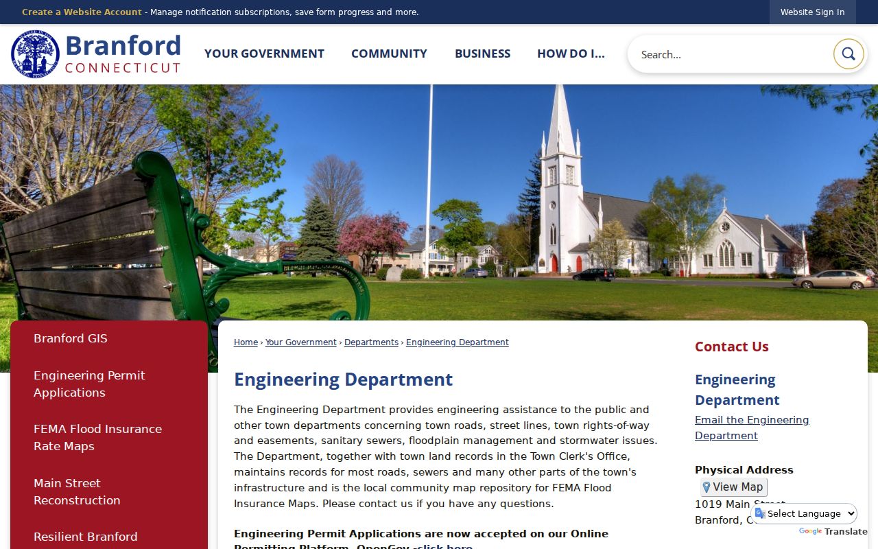
Branford Engineering contact information lists 203-315-0606. Ask for a named record and date range, use the office or a written public-record request, and then compare the result with the Town Clerk's book, map, or survey index. Keep road and infrastructure evidence separate from an owner label or dated directory entry.
Branford Street Permits by Address
Newer Branford permit work follows OpenGov. Branford says the system supports applications, payments, status tracking, review comments, inspection findings, and parcel-linked records across Building, Engineering, Planning, and Conservation and Development. Online permitting became required October 1, 2025. The Branford OpenGov portal returned an inaccessible-application notice during the August 20, 2026 research inspection.
An inaccessible portal is a documented gap, not an empty result. Request an older or unavailable permit by parcel, permit number, project type, and date range from the responsible department or through a focused public-record request. The public research did not capture exact OpenGov search controls, result columns, historical retention, or download options.
Branford permit records add a date marker for a Branford address. They do not replace the deed chain, turn a project applicant into an occupant, or establish that every household member is connected to the parcel. Keep project status and inspection fields in their own source row.
Branford Street Place Labels and ZIP
Address normalization has a local geography layer. USPS material lists Branford, Short Beach, and Stony Creek place lines under ZIP 06405. Pine Orchard appears in town planning and association context. Historic districts and map layers also use Branford Center, Branford Point, Canoe Brook, Stony Creek and the Thimble Islands, and Short Beach. Preserve the place label, but normalize the legal municipality as Branford.
The Branford GIS data-download page gives the version labels that belong beside a normalized street row.
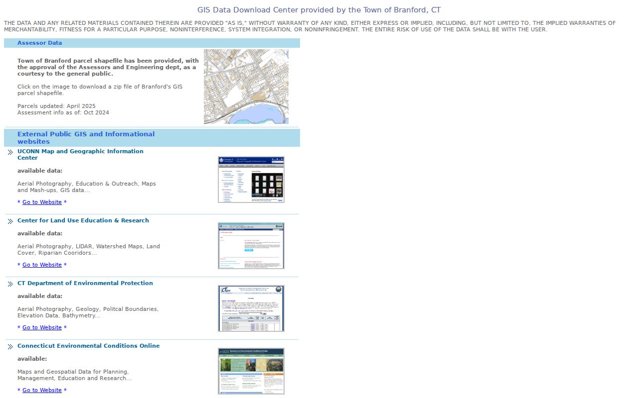
The Branford page labels parcels updated April 2025 and assessment data from October 2024. Do not turn a place label or ZIP into a town boundary. Compare the USPS result, parcel MUNI and situs fields, and legal description when the address matters.
No official ZIP boundary map, ZIP realignment timeline, or complete Branford street-renumbering history was located. The 2021 Branford street list is a spelling and range aid, not legal boundary evidence. For an old line, retain the historical wording and add a separate modern normalization field.
Note: Short Beach, Pine Orchard, and Stony Creek can guide a record search, but a place label does not establish a separate municipality or household connection.
A Branford Street Criss-Cross Entry
A criss-cross directory is an address-first historical source. The Blackstone Branford directory guide identifies material from 1895, a nonannual run, and a street index from 1928. The 1909 volume includes names, places, civic, church, school, cemetery, post-office, and town-officer sections. It is street context, not a modern roster.
For an older Branford address, search the Branford street index when the year supports it, check the resident section, and retain the page or image citation. Preserve landmarks and older spellings. Compare the entry with a newspaper, census, church or cemetery index, or land record. A missing year does not prove a street was vacant.
Full collections belong with the Branford city directory collections. The street directory uses a historical entry only to support an address trail anchored to Vision, GIS, Engineering, and the Town Clerk.
- Parcel
- A mapped land unit keyed in Branford by identifiers such as PID or MBLU; a unit or complex may sit inside the same street address.
- Situs address
- The physical location assigned to the parcel, kept separate from a mailing address used for record delivery.
- Plat
- A recorded or survey map that gives lot, subdivision, or boundary context; the deed, survey, or Town Clerk record controls when the line is legal.
- Criss-cross directory
- A dated reverse directory arranged by street or address, then connected to names in the resident portion of the volume.
What Branford Street Records Leave Out
Branford street records answer parcel, legal, map, election, project, engineering, or dated-listing questions. No single public source shows every person connected to a Branford address. An owner label, mailing line, deed party, voter registrant, directory entry, and permit applicant are distinct record roles. Protected voter or Safe at Home rules may withhold or substitute an address, while vital and court records have their own limits.
Lawful personal use. Branford address records can support property history, genealogy, civic review, or checking a source. Do not stalk, harass, intimidate, or publish unnecessary personal details about another person. Stop when a protected-address or access rule applies.
A no-result may reflect login, retention, sealing, privacy, an interface rejection, or an unlocated coverage date. Keep retrieval, record, and update dates beside the Branford source key. Use the Branford Assessor, Town Clerk, Registrar, Engineering office, or Blackstone for correction, certification, or the next record.